


Historical Sea Charts
Visions and Voyages Through the Ages
Log in to add this to your wishlist.
Share This Book...
- Readers will find out how the maps were designed and created, as well as how they were used during navigation or in preparation of the journey
Full Description
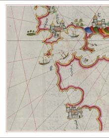
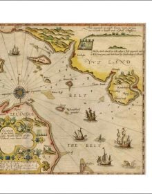
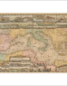
This book shows the history of charts and nautical maps from the earliest known examples to the one used in the Twentieth Century, with a special focus on the map makers and the methods of use from 1300 to 1900. The maps included are part of the collection owned by Barry Lawrence Rudeman Antique Maps Inc., the world leader institution for nautical maps. The reader can find in this book the most indicative of trends and ideas through time. For each example in the volume, the reader will find out how the maps where designed and created, as well as how they were used during navigation or in preparation of the journey.
Specifications
- Publisher
- White Star
- ISBN
- 9788854417168
- Published
- 17th Oct 2023
- Binding
- Hardback
- Territory
- World excluding USA & Canada; India non-exclusive; Italy non-exclusive
- Size
- 315 mm x 275 mm
- Pages
- 208 Pages
- Name of series
- Through the Ages
Distributed by ACC Art Books
View All
Our Catalogues
Our Catalogues
Recently Viewed
Please log-in or create an account to see your recent items.